


News
by NK (comments: 0)
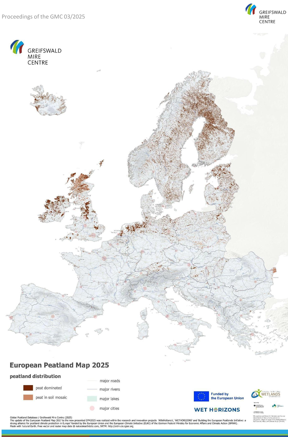
New European Peatland Map
now available online
23/09/2025 The European Peatland Map (EPM2025) is now available on our website (including the geodata). It is a product of the Global Peatland Database (GPD), which is hosted at the Greifswald Mire Centre (GMC). It contributes to a consistent and regularly updated knowledge base on peatlands worldwide.
The dataset provides the most up-to-date overview of European peatlands. The EPM2025 integrates current national, regional and local datasets on peatlands and organic soils to represent peatland areas as comprehensively as possible, including degraded and drained peatlands, i.e. those used for agriculture. By providing the data in vector format, the map offers high spatial resolution, making it an indispensable resource for research, policy and nature conservation.
The EPM2025 is based on the peatland layer of the European Wetland Map (2024) but is directly accessible without the need for extraction from the more comprehensive wetland layer. It updates the ‘Peatland Map of Europe’ (Tanneberger et al. 2017), with all national datasets having been reviewed and replaced by more comprehensive or better quality GIS data According to the geodata, the total area of peatland in the countries covered is 38.4 million hectares (384,220 km²).
The EPM2025 was created as part of two EU-funded Horizon projects (ALFAwetlands and WET HORIZONS) and the European Climate Initiative (EUKI) of the Federal Ministry for Economic Affairs and Climate Protection (BMWK) and represents the best available knowledge at European level. More importantly, it is designed as a shared and evolving knowledge base and represents a warm invitation to the scientific and conservation community to further verify, refine, and continuously improve the data at national and regional scales across Europe.